Location 1. Felsic rock at NT958180
Location 2. Track up Hedgehope at NT952187
Location 3. Boulders near summit at NT94554 19489
Location 4. Hedgehope Hill summit NT943198
This excursion enables us to put to the test Al-Hafdh’s proposals regarding the distribution of rock types as evidence for a Cheviot ring dyke system.
We will:
– investigate the Dunmoor Burn looking for his ‘Woolhope’ type of granite, – search for the contact between his medium-grained ‘Hedgehope’ type and the coarse-grained ‘Standrop’ type that he reports on the north side of Hedgehope Hill
– sample Great and Little Standrop rocks
– and look for some sign of contact between the different granites on the south side of the hill below Standrop Rigg that would support Al-Hafdh’s mapping of rock distribution.

Map showing the excursion route, locations and igneous rock types


Having parked at Hartside and walked the road to Linhope, followed the track below Ritto Hill and then N.E. to the bridge over the Linhope Burn, we walk the short distance to the sign-posted track through the gate northwards up the slope of Hedgehope Hill.
We leave the path and head east across rough ground, down the steep slope towards the Dunmoor Burn and our first location at NT95894.
In this area, there are exposures of a very fine-grained, pink to red granitic rock that Al Hafdh identifies as the ‘Woolhope’ granite type. He suggests these exposures represent part of the ring dyke system, shown on the map below, that is important to an understanding of the origin and structure of the Cheviot complex.


Comparison with the fine-grained granitic rock at Woolhope Crag (click here for a visual analysis of a sample of this rock) suggest that whilst the two rocks do share a superficial, fine-grained felsic character, they are unlikely to be of the same type intruded at the same time.
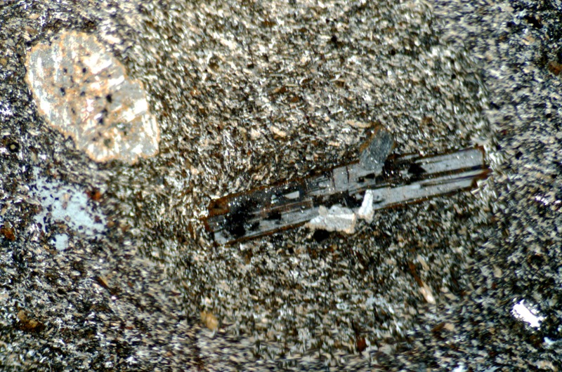
The Woolhope Crag rock has a granular appearance whereas this rock is much finer-grained, with flow structure and, what looks like, xenocrysts suspend in it.
Perhaps the rock at this location is more closely related to the felsite dykes that the BGS map show cutting across the Dunmoor Burn downstream.
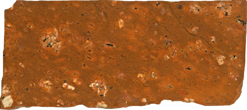

Flow structures and, what may be, xenocrysts are visible in the fine grained material. The grey area to the right is a hole in the section.
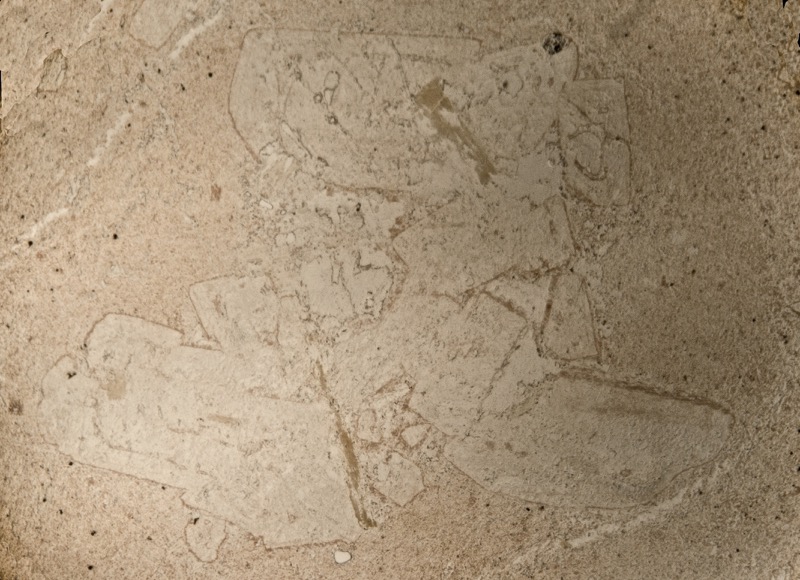
Section viewed in plane polarised light


Viewed with crossed polarising filters, flow structures are evident in the fine-grained material.

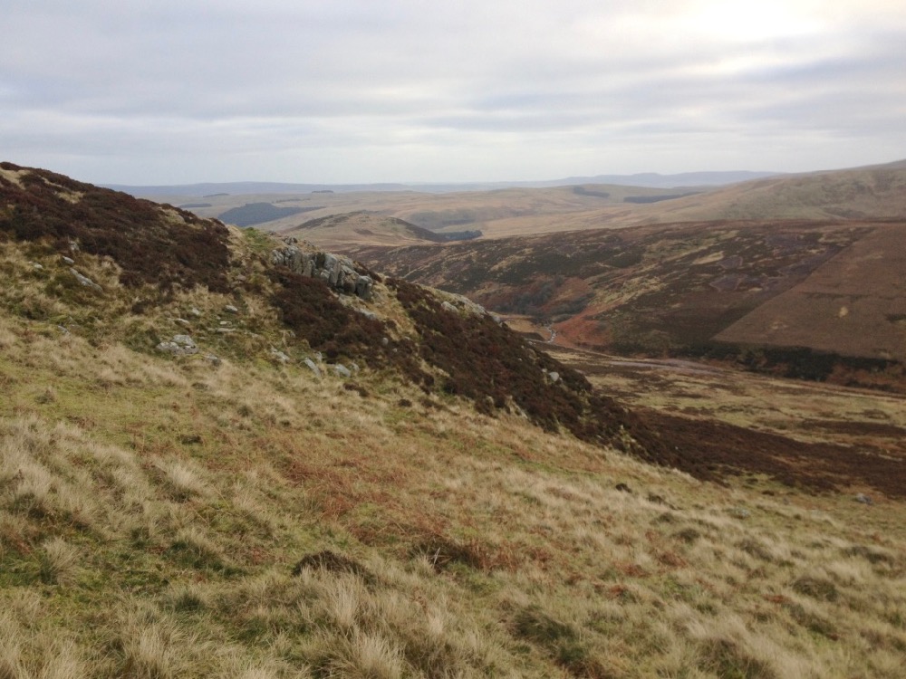
Hedgehope is on the far right with Standrop Rigg towards the centre.
Returning to the track, we continue walking up the flank of Hedgehope Hill.
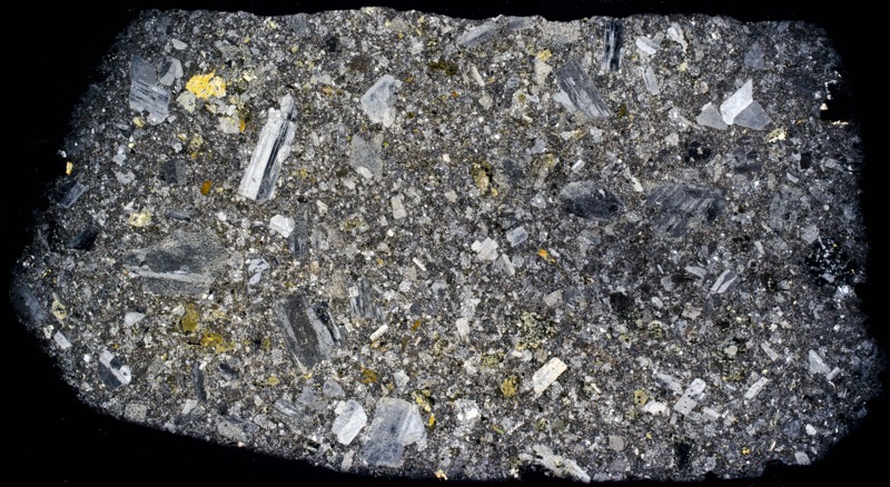
The many large boulders that lie half-buried in the peat and heather may have been transported here by ice, water and gravity, so they are questionable guides to the bedrock concealed below. That said, the sample from one of them shown below is an interesting one because it appears to be andesite.
The rock has a fine feldspar matrix and is highly altered, much of it to a dull red colour with sericitised plagioclase, black and green blotches of biotite, much chlorite and the occasional patches of black tourmaline and epidote. Of the larger crystals in the rock, some are plagioclase phenocrysts while others look more like xenocrysts. There are no andesite outcrops in this vicinity, so how did this boulder come to be here?
It could have been transported here from a different locality or it could be a remnant of the pluton’s roof that would have been situated above and quite close to this location.
Specimen 1

Prepared sample viewed in reflected light


Plagioclase with inclusions viewed with crossed polarising filters.
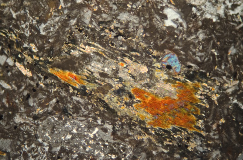
Plagioclase with inclusions viewed with crossed polarising filters.

Section viewed with crossed polarising filters.
A little further uphill there are boulders of a sub-equigranular granitic rock. A sample from one boulder contains no pyroxine or biotite, the latter having been altered to chlorite and some larger patches of white mica and possibly also to the tourmaline that appears here.
Most of the plagioclase has lost its polysynthetic twinning having been altered to albite or orthoclase and sericite.
Some of the quartz and potassium feldspar has formed micrographic inter-growths that may have formed at the time of first crystallisation or may have resulted from later alteration.
Specimen 2

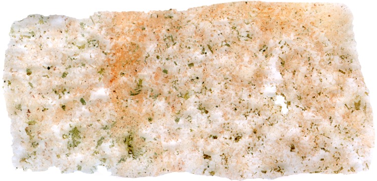
Prepared specimen viewed in reflected light.


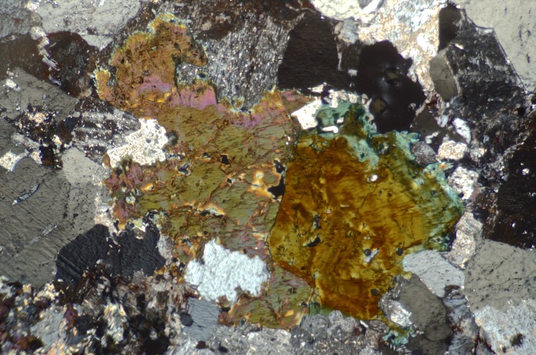
Most of the plagioclase in this altered rock has lost its polysynthetic twinning and is heavily sericitised. Section viewed with crossed polarising filters.

Section viewed with crossed polarising filters.

Prepared specimen viewed in reflected light.

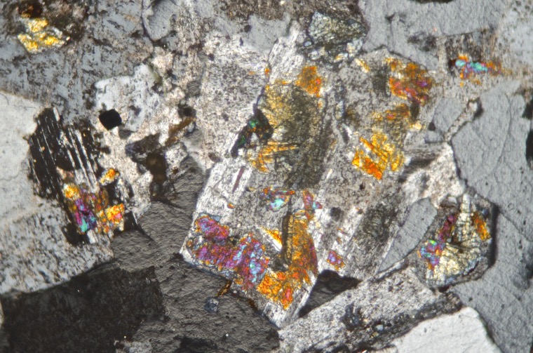
SThe summit of Hedgehope Hill is scattered with the boulders of medium-grained porphyritic rock similar to that found at Long Crag on Dunmoor Hill.
There are many rocks here that show evidence of severe hydrothermal alteration resulting in the disappearance of pyroxenes and biotite, the conversion of plagioclase to albite along with the appearance of secondary minerals that include sericite, chlorite, tourmaline, quartz, haematite and limonite.
Specimen 1.
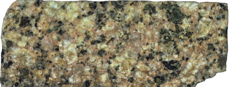
Prepared specimen viewed in reflected light.

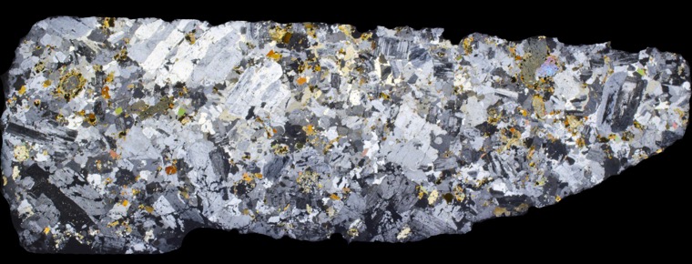
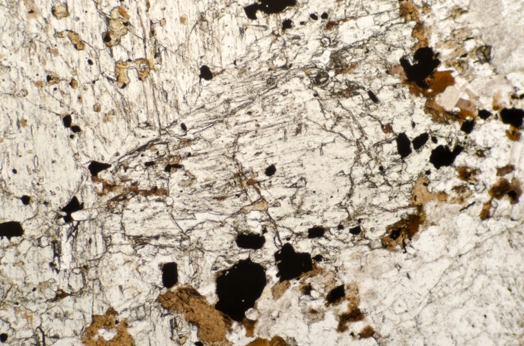


Sample viewed with crossed polarising filters.

Sample viewed with crossed polarising filters.
Specimen 2.

Prepared specimen viewed in reflected light. The dark material is mostly tourmaline.
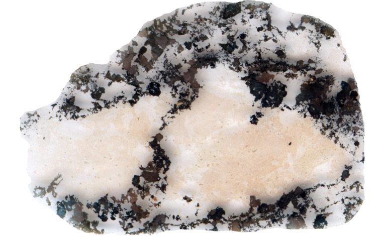


Section viewed with crossed polarising filters.
There are feint traces of remaining polysynthetic twinning in the plagioclase crystal at top left.
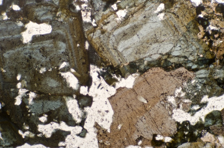
Section viewed in plain polarised light.
A dyke curves across the summit of Hedgehope Hill that the British Geological Survey identifies as a quartz-porphyry type.
This type of dyke is characterised by the presence of phenocrysts of quartz and usually albite and biotite in an iron-stained, devitrified quartz-orthoclase groundmass. The groundmass can be sub- or micro-crystalline and if the latter, then often with some granophyric texture. Generally, the quartz phenocrysts are rounded and free from inclusions or cavities and the plagioclase phenocrysts are albite or have a composition between albite and andesine. The plagioclase is frequently turbid and sericitised. Feldspar may also be present as perthite and anorthoclase.
Fresh or altered biotite is common but hypersthene and augite, or a calcite pseudomorph after augite, are seen more rarely. Occasionally, large crystals of apatite can be found. Iron-titanium ores are sparse occurring mostly around relict biotite crystals.
Carruthers identifies the Hedgehope summit dyke as being of interest, ‘…in that it contains nests of a highly birefringent yellow mica, which is either zinnwaldite or polylithionite.’
Our sample is from a point of contact between the dyke and the granite at the north end of the dyke. The contact is sharp with some chilling of the dyke rock against the granite that appears to be only slightly changed by the intrusion. Fragments of the granite have been torn off becoming xenoliths in the dyke and the outermost crystals in contact with the intrusion have cracked in line with the boundary, allowing strings of tiny quartz and feldspar blebs to form inside.

Prepared specimen viewed in reflected light.


Thin section viewed in plane polarised light.

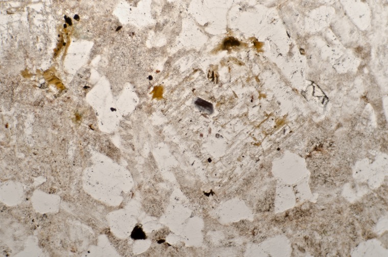
Thin section viewed in plane polarised light.
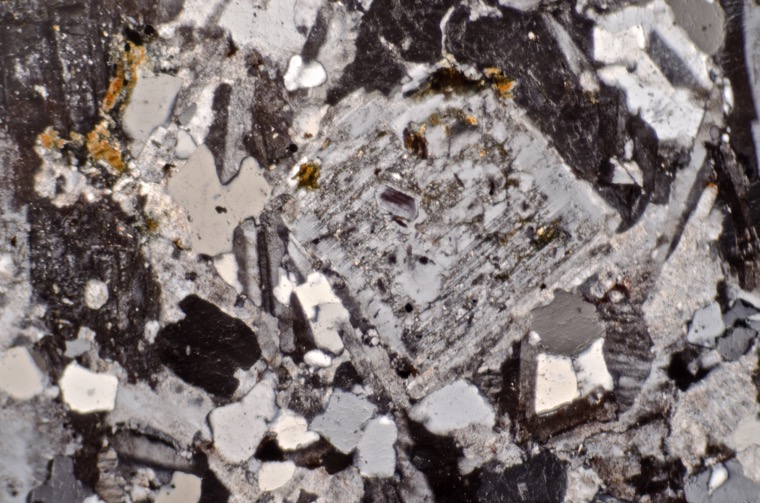

Section viewed in plane polarised light
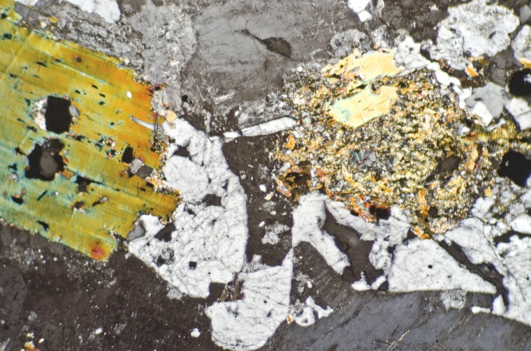
Section viewed with crossed polarising filters.

Thin strings of quartz and feldspar blebs have formed along the cracks in the host rock. Section viewed with crossed polarising filters.
From the summit of Hedgehope Hill we head down to Standrop Rigg comprising of the twin mounds of Great Standrop to the left and the smaller mound of Little Standrop to the right. The steeper, first part of the walk is over rough ground but we soon pick up a rough track that leads over to the Rigg.

The rock that makes up the outcrops and boulders at Little Standrop is, predictably, the coarse-grained, grey coloured ‘Standrop’ Central Belt type.


Prepared specimen viewed in plane reflected light. The sample measures 44mm across.

The section measures 40mm across


Section viewed in plane polarised light (FoV 4.6 x 3.0 mm)
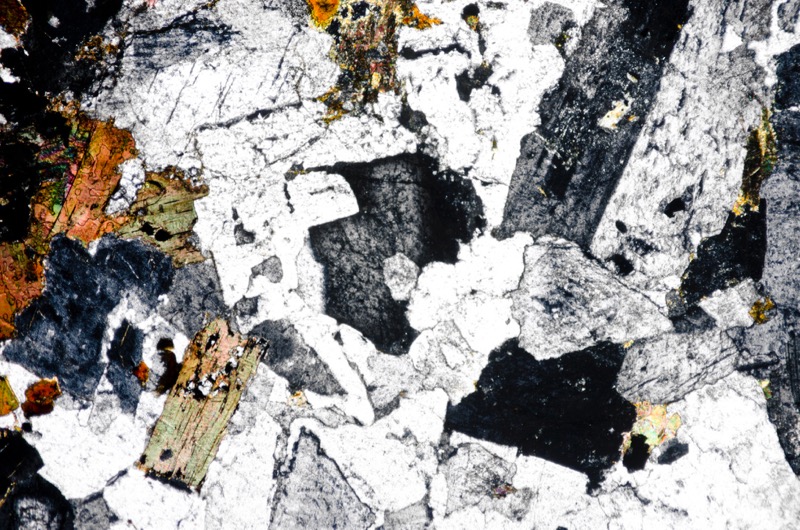
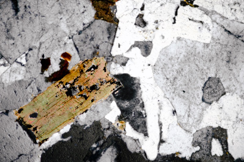
Section viewed with crossed polarising filters (FoV 2.3 x 1.5 mm)
A short walk from Little Standrop brings us to Great Standrop. The rock appears to be much the same in character and distribution.


Prepared specimen viewed in plane reflected light. The sample measures 45mm across.

The section measures 38mm across


Section viewed in plane polarised light (FoV 4.6 x 3.0 mm)
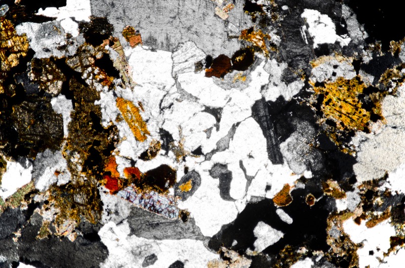

Section viewed with crossed polarising filters (FoV 2.3 x 1.5 mm)
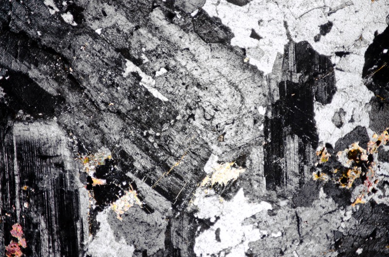
Section viewed with crossed polarising filters (FoV 4.6 x 3.0 mm)
We head down towards the track that will take us back to Linhope. We sample the topmost part of an outcrop that is slightly less coarse and more reddish than that on Standrop Rigg. In thin section we see both coarse and fine granophyric texture.
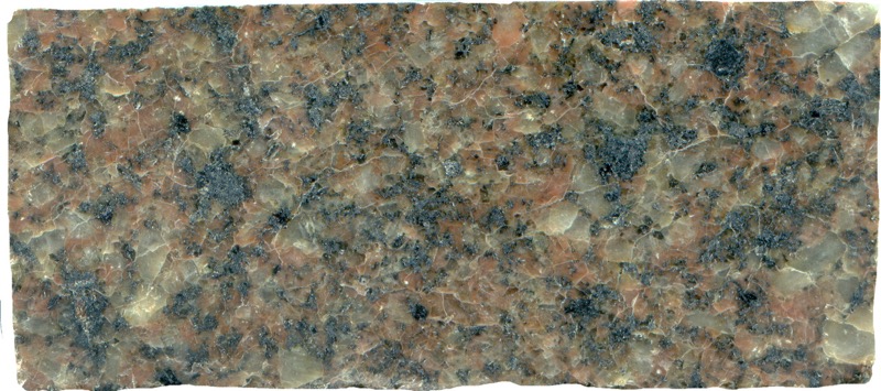
Prepared specimen viewed in plain reflected light (44mm across)


Section viewed in plane polarised light (FoV 4.6 x 3.0 mm)
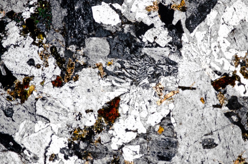

Section viewed with crossed polarising filters (FoV 2.3 x 1.5 mm)

The outcrop continues down and then east for a short distance with many boulders at its base. In a thin section of one sample we find a nice patch of amphibole displaying typical amphibole 60o/120ocleavage.
Some primary pyroxene and biotite survives in the rock but much has been altered.
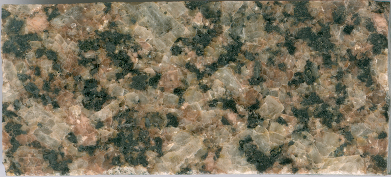
Prepared specimen in ordinary reflected light.
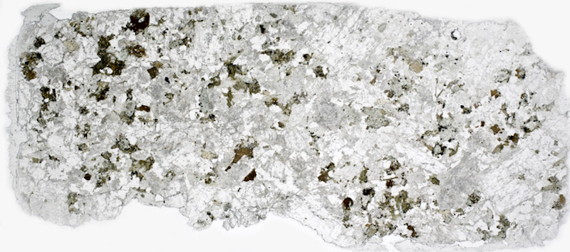
Thin section from the same specimen viewed in plane polarised light.


The amphibole has the typical 60o/120ocleavage. Section viewed in plane polarised light

Section viewed with crossed polarising filters.

As we contour around the side of the hill we come across a boulder bearing the contact between felsite and ‘Central Belt’ rock.
A felsite dyke doesn’t appear on the map here and we don’t see evidence of one nearby, so this boulder may well have been dumped here from further afield by ice or water.

Prepared specimen in ordinary reflected light.
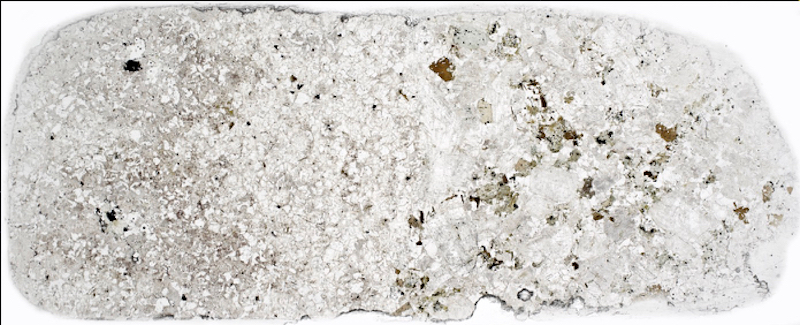


Section viewed with crossed polarising filters

Section viewed with crossed polarising filters (FoV 5 x 3.3mm)

Section viewed with crossed polarising filters (FoV 1.3 x 0.8)

Slightly further east, there is a substantial outcrop of coarse-grained Central Belt rock that has some coarse granophyric texture.
This rock appears mid-way on a spectrum between the coarse-grained rock we found on Standrop Rigg and the much finer-grained, ‘granophyric’ rock that we found on the track up to Hedgehope’s summit.

Prepared specimen in ordinary reflected light (40mm across)

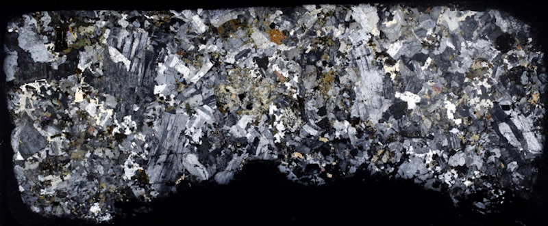
References
Al-Hafdh, N.M. 1985. The Alteration Petrology of the Cheviot Granite. Thesis submitted for PhD. at Newcastle University.
Robson D.A. 1976 A Guide to the Geology of the Cheviot Hills Transactions of the Natural History Society of Northumbria, Newcastle Upon Tyne Vo. 43, No. 1.
British Geological Survey Online geology map http://mapapps.bgs.ac.uk/geologyofbritain/home.html
Carruthers, R G, Burnett, G A, Anderson, W, and Thomas, HH,1932. The Geology of the Cheviot Hills (Based on the work of C.T. Clough and W. Gunn) HMSO