Location of the Crookdene dyke
The Crookdene dyke is exposed in the woodland of Crook Dene which lies 10 miles to the west of Morpeth. Itwas first described by geologists M.K. Heslop and J.A. Smith in a paper read at the Geological Society of London by G.A. Lebour in November 1909. They wrote, the dyke is exposed, ‘in the bed and banks of the Wansbeck, which is there a small stream. Close by is the farm at Crookdene, a name which may serve to distinguish this dyke. The exposure is greatly obscured by talus; three patches of the rock can, however, be examined: one at the top of a steep bank about 30 feet high, another about half way down the bank, and a third the foot of the bank and in the burn.’
A map of the Crookdene area showing the roads, footpaths, dene, bedrock, dyke and bedrock types


Heslop and Smythe describe a, ‘broad, breccia-filled fissure 12 feet wide,’ running up the steep slope in line with the dyke but, as the first photograph shows, this feature is no longer visible and we were unable to find the middle and high exposures under the trees, soils and branches – only loose pieces of limestone.
However, in a dry spell when the river level was low, we did find the exposure at the bottom of the slope, butting up on its northern side against the limestone that projects out into the water. It is a small exposure coming to an abrupt end in the stream suggesting it culminates here even though the current BGS map shows it continuing further west beyond the woodlands.


Petrography and Petrology
Heslop & Smythe investigated the Crookdene dyke at a time when the dykes of the Permian tholeiite basalt suite were being identified and distinguished from the dykes associated with Great Whin Sill. Reading their paper, it is easy to imagine their excitement in the discovery that the basalt of Crookdene dyke was verysimilar to the rock of the Hartley and Seaton Sluice dykes in the Collywell Bay vicinity on the Northumberland coast. This led to their conclusion that ‘the Collywell and Crookdene dykes are in reality one,’ with clear relations to the Morpeth and Tynemouth dykes.
They describe the rock as a fine-grained basalt composed of feldspar, augite and iron oxide crystallised in that order. The feldspars appear as ‘narrow laths around which the augite is wrapped in curved strands. Iron oxide in small skeleton forms (are) not plentiful.’
They also describe the ‘amygdaloids of calcite, with dark residues’and, in the now inaccessible exposure halfway up the bank, the ‘large inclusions of anorthite’ – one of which measured six inches.
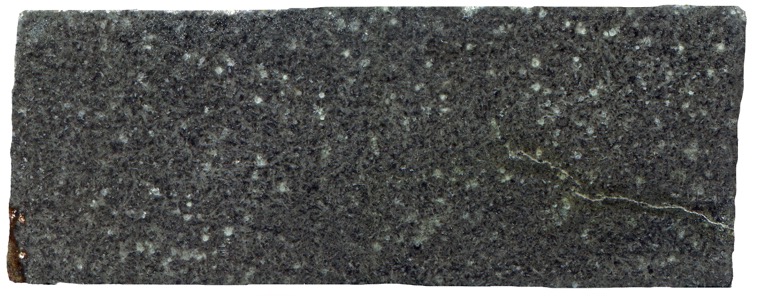
Specimen viewed in reflected light.


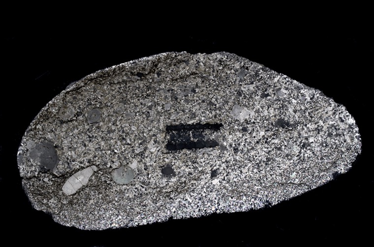
Much of the dyke rock at the bottom of the slope is cabonatised but we did find a specimen that was relatively unaltered. The rock is fine grained with few vesicles most of which are filled with calcite with some ‘dark residue’.. Most of the pyroxene is fresh and granular, only rarely does the mineral approach anything like the scrolled, acanthus-like structures that Heslop and Smythe report. There are no anorthite glomerocrysts; these must be restricted to the higher exposures although a few small fragments of individual zoned, calcium-rich plagioclase crystals are present.


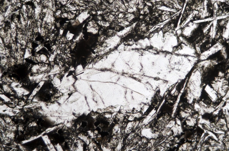
Sample viewed in plane polarised light (FoV 1.2 x 0.8 mm)

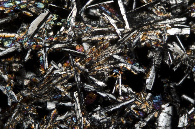
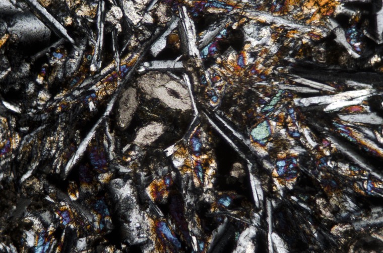
Sample viewed with crossed polarising filters (FoV 1.2 x 0.8 mm)
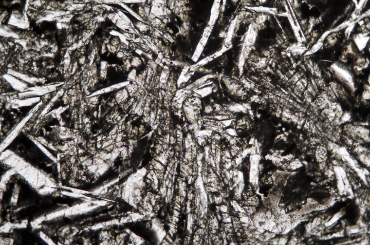
Sample viewed in plane polarised light (FoV 1.2 x 0.8 mm)


Sample viewed with crossed polarising filters (FoV 1.2 x 0.8 mm)
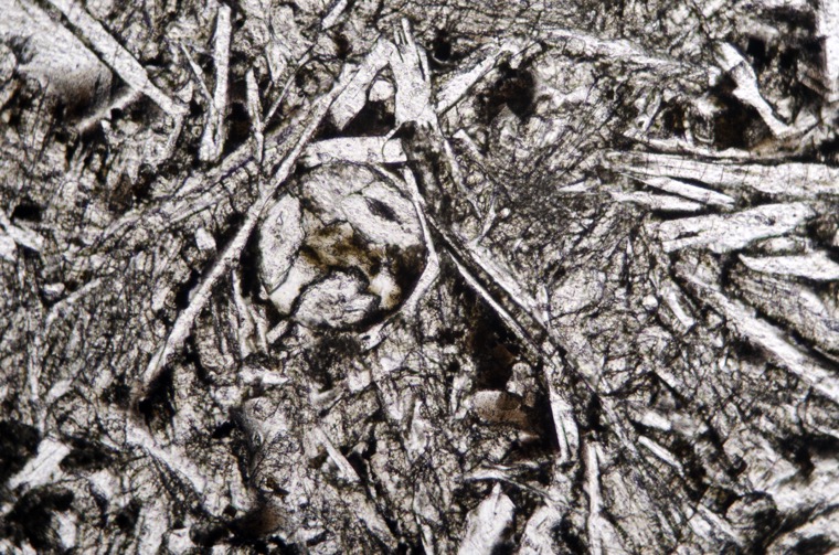
Section viewed in plane polarised light (FoV 1.2 x 0.8 mm)